Research
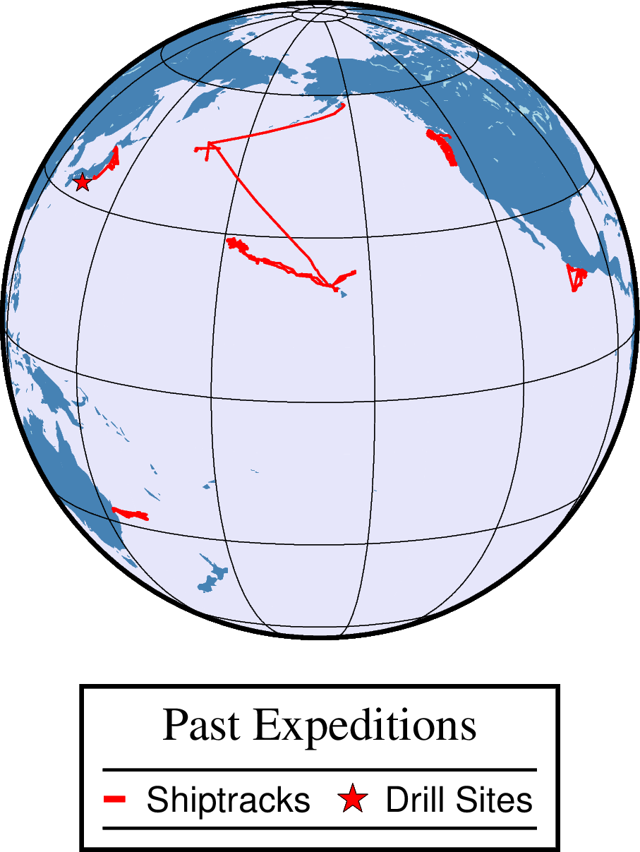
I use marine geophysics to study how the Earth’s tectonic plates form, bend, break, subside, and slide past each other. I’m interested in the large-scale processes that shape the Earth’s crust and upper mantle, and how these processes affect people and cities, leading much of my research to focus on the complex interactions that occur at plate boundaries. I mainly focus on controlled-source seismic data but also incorporate a variety of other geophysical techniques to further deepen our understanding of each tectonic setting.
Hawaiian-Emperor Seamount Chain
Starting at the Big Island of Hawaii and extending to the Aleutian Trench, the Hawaiian-Emperor Seamount Chain is a classic example of a hotspot seamount chain. Check out our blog for information on a recent seismic cruise series using R/V Marcus G. Langseth and click below for some initial publications.
- Xu, C., et al., (2022). A seismic tomography, gravity, and flexure study of the crust and upper mantle structure of the Emperor Seamounts at Jimmu guyot. link
- Watts, A. B., Grevemeyer, I., Shillington, D. J., Dunn, R., Boston, B., Peña, L. G., (2021). Seismic structure, Gravity anomalies and Flexure along the Emperor Seamount chain. link
- Watts, A. B., Tozer, B., Harper, H., Boston, B., Shillington, D.J., Dunn, R., (2020). Evaluation of shipboard and satellite-derived bathymetry and gravity data over seamounts in the northwest Pacific Ocean. link
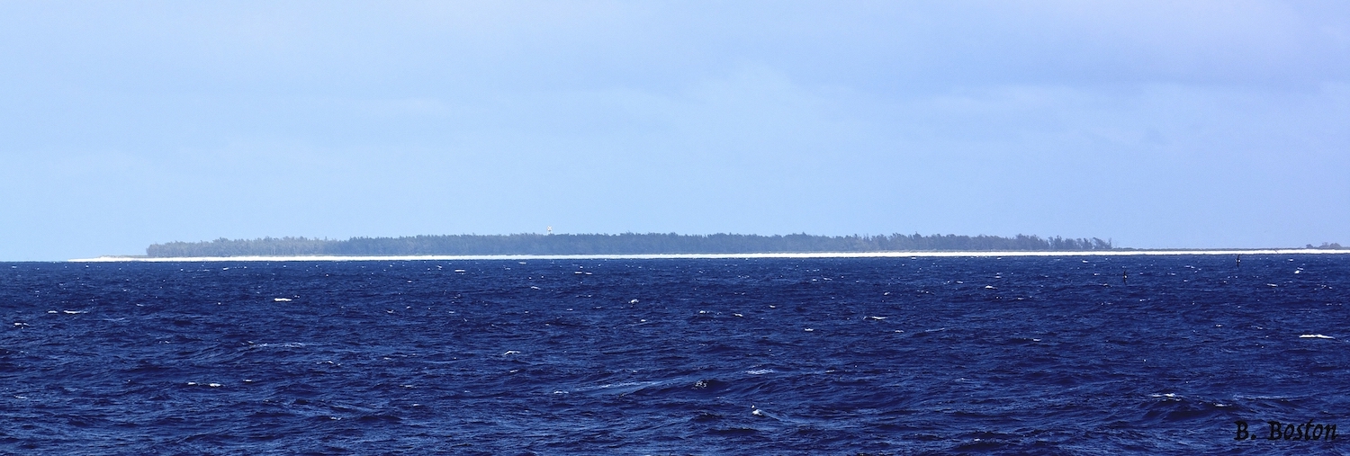
A previous sonar cruise on the Hawaiian Ridge up to just NW of Kure and Midway Atolls mapped 19 seamounts and discovered deep guyots, likely old preexisting Cretaceous seamounts, intertwined with ones from the Hawaiian Chain.
- Kelley, C., Smith, J.R., Miller, J., Tree, J., Boston, B. et al., (2015) New Insights from Seafloor Mapping of a Hawaiian Marine Monument. link
Subduction Zones
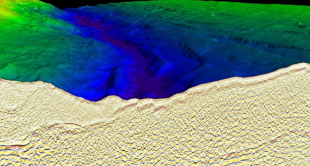
These regions where plates collide produce some of the largest earthquakes, create huge tsunamis, and contain highly deformed belts of rock. My work on subduction zones has covered a range of settings, from the incoming plate to the inner accretionary prism and overlying forearc basin.
Cascadia
Located in the backyard of the Pacific Northwest, the Cascadia subduction zone is one of the greatest geologic hazards for the US, with earthquakes reaching up to Mw 9.0. During the Cascadia Seismic Imaging Experiement 2021 (CASIE21), we imaged along the whole margin to better understand the earthquake and tsunami hazards throughout this region. Check out our website or blog to learn more about how and why we collected the data, or see what others are saying about the research cruise. Stay tuned for research coming out!
Middle America Trench
At the Middle America Trench, the Cocos oceanic plate slides underneath the North American plate, regularly producing large and devastating earthquakes. The Guerrero seismic gap is one of the few areas along this subduction zone that has not experienced any large earthquakes in the last 100 years. In 2022, we collected a large suite of geophysical measurements including seismic reflection and wide-angle seismic relfection/refraction data. To learn more check out our blog and look out for future results.
Some past research in this region includes:
- Edwards, J. H., et al., (2021). In-situ mass balance estimates offshore Costa Rica. link
Japan Trench
The great 2011 Mw 9.0 Tohoku-oki earthquake at the Japan Trench produced huge co-seismic slip and created the tsunami that devastated much of northeast Japan. I sailed on a rapid-response cruise led by JAMSTEC soon after the earthquake to collect seismic data along this margin.
- Boston, B. et al., (2017) Forearc slope deformation above the Japan Trench megathrust: Implications for subduction erosion. link
- Boston, B. et al., (2014) Outer-rise normal fault development and influence on near-trench décollement propagation along the Japan Trench, off Tohoku. link
Nankai Trough
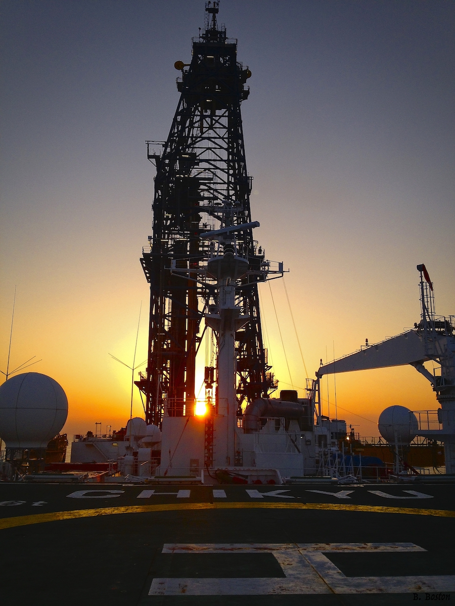
Due to its potential for great earthquakes, there is a tremendous amount of work to be done at this margin to study earthquake and subduction zone processes. My work has used the Kumano 3D seismic volume, and I sailed on D/V Chikyu to drill deep into the inner accretionary prism.
- Boston, B. et al., (2016) Deformation of the Nankai Trough inner accretionary prism: The role of inherited structures. link
- Moore, G.F., Boston, B. et al., (2015) Evolution of Tectono-Sedimentary Systems in the Kumano Basin, Nankai Trough Forearc. link
- Moore, G.F., Boston, B. et al., (2013) Analysis of normal fault populations in the Kumano Forearc Basin, Nankai Trough, Japan: 1. Multiple orientations and generations of faults from 3-D coherency mapping. link
- Tobin, H., et al. (including B. Boston), (2015) NanTroSEIZE Stage 3: NanTroSEIZE plate boundary deep riser 3. Proceedings IODP 348. link
- Taladay, K., Boston, B. et al., (2017) Gas-In-Place Estimate for Potential Hydrate Concentrated Zone in the Kumano Basin, Nankai Trough Forearc, Japan. link
- Brown, K., et al. (including B. Boston), (2017) The action of water films at Å-scales in the Earth: Implications for the Nankai subduction system. link
Continental Rifting and Breakup
Rifted continental margins are one of the longest tectonic features on Earth, and the process of continental breakup that took place at these margins is fundamental to plate tectonics and the formation of new ocean basins.
Zealandia

Located in the SW Pacific, Zealandia has been refered to as the “Hidden Continent” since ~94% of it is submerged beneath the ocean. During the Cretaceous, eastern Gondwana started continental rifting and breakup to separate northern Zealandia from eastern Australia. Due to its remote location, little work has been done to understand the structure and breakup of the margin. I sailed on the R/V Kairei as part of a multi-leg survey to collect seismic reflection data and wide-angle seismic data to study this unique continental endmember.